
The two dominant colours on the moon’s surface are dullish grey and pitch black – but only to the naked eye. The geological materials and phenomena that shaped the moon display such a wealth of differences that space geologists (in this case selenologists) have had to code them in a wide range of colours. An unintended side-effect of geological clarity is this joyous jumble of colour-coded impact craters, reminiscent of Jackson Pollock’s action painting. Source: US Geological Survey,

This map, made by Stephen Von Worley at Data Pointed in 2009, is probably, sadly, already out of date – at the time, there were more than 13,000 McDonald's restaurants in the US, or one for every 23,000 Americans. Within the thunder of dots, it also contains the McFarthest Place, tucked away in the wild uplands of South Dakota, 145 miles from the nearest McDonald's.

The 14th-century Zeno brothers could have been the initiators of the Age of Discovery – if only the lands they had found had been real. The Venetians sailed back from the north Atlantic with fantastic tales of Frisland, Icaria, Estotiland, and other phantom islands. They made for such good stories that it took centuries before the last of them disappeared off the map.

The term 'bumboat' has nothing to do with a person’s posterior; but that didn’t stop James Gillray from seizing upon its name to devise a patriotic caricature of England, defecating in France’s general direction. The year is 1793, and the talk is of a French invasion. The silhouette of John Bull is moulded to fit the shape of Britain, a contemptuous stream of 'leavings' radiating from his 'south coast'. The map of France also resembles a person – Brittany the chin, Normandy the nose – less than pleased about taking this stream of scatological invective straight in the face.

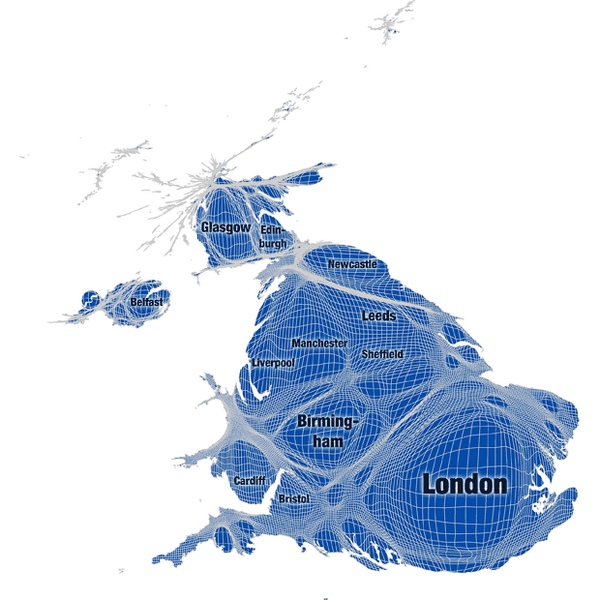
Football fandom is a complex compound of ancestral, social, and regional loyalties. And of personal choice, of course. There are no neat borders to be drawn around the 'fanlands' of each team, as indicated by the cross-hatched areas on this map, which reflect zones of mixed allegiance. Short of mapping the allegiance of every individual fan, attempts to make geographic sense of individual, subjective preferences – like this football supporter map of London – will remain rather imperfect. And great conversation pieces.

This map is a metro-spotter’s wet dream. It shows all the cities in the world that have, or are planning, an urban rail system of some sort. Like the iconic London Underground map based on Harry Beck’s 1933 original, this one sacrifices geographic correctness for ease of use. Europe’s relatively dense network spills over into Asia; South America is reduced to a single loop. Of course, this is a map for daydreaming: wouldn’t it be great you could take the tube in London and get off, many stops later, in Pyongyang or Mexico City?

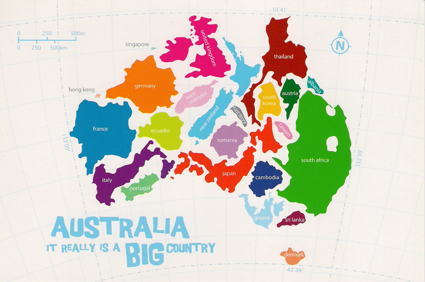
This snapshot was taken just before the world economy took a turn for the worse in 2008, but since a falling tide lowers all boats, its main lesson still applies: the US economy is massive. So massive that the GDP of each of its 50 states compares is the same size of an entire other nation. California equals France. Ohio is Australia. And the economy of tiny Delaware amounts to that of Romania.

California may have been named after a fictional island in a 16th-century Spanish romantic novel. That – and the elongated peninsula of Baja California – helps explain why early cartographers showed it as detached from the North American mainland. Even though expedition after expedition reported the misconception, an insular California clung to maps for as late as the 18th century – a triumph of wishful thinking over reality. Which is not a bad description of California as it is today.

By the time Heinrich Bunting made this map – the end of the 16th century – the age of discoveries had destroyed the legitimacy of sacred geography that placed Jerusalem at the centre of a symmetrical, shamrock-shaped world. Bunting even includes America in this map, which apparently is conceived both as an amusement and as a tribute to Buntings hometown of Hanover, in the coat of arms of which the cloverleaf figures prominently
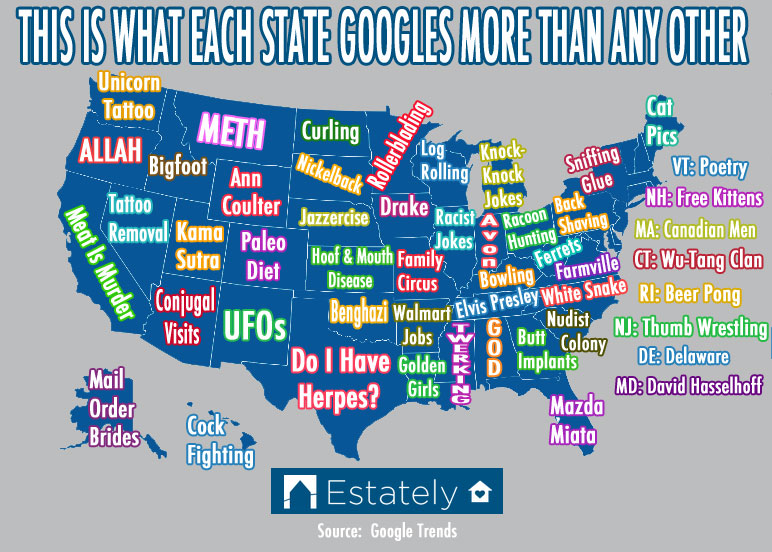
source